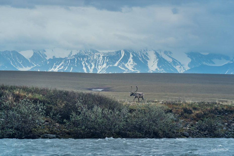
This post is part one in a series on the Draft EIS. Our goal is to explain and contextualize the Draft EIS to allow our readers to make educated comments on the subject. We will also be looking at the public comment process and explaining how readers can best make a difference regarding drilling in the Arctic National Wildlife Refuge. Thanks to Dan Ransom for sharing his beautiful photos from a trip to the Refuge last summer.
The Arctic National Wildlife Refuge is a 19.5 million acre swath of largely roadless tundra in northeast Alaska. It’s one of the largest wildlands in the United States that has not been dramatically altered by human
In 2017, Congress passed the Tax Cuts and Jobs Act which included provisions opening 1.5 million acres of coastal plain in the Arctic National Wildlife Refuge to oil and natural gas extraction. Alaska Senator Lisa Murkowski spearheaded the effort, which has had long-standing support from Alaska republicans.
The Bureau of Land Management (BLM), the federal agency with authority over mineral extraction in the Refuge, is required to produce an Environmental Impact Statement (EIS) before moving forward with oil and gas leasing. This is done to ensure federal compliance with the National Environmental Protection Act (NEPA).
To completely perform the necessary environmental assessment, the preparing agency and its consulting partners must accurately evaluate all environmental concerns relevant to a given action, taking into account both input from affected communities and the best available scientific information. After holding stakeholder meetings in Alaska and Washington D.C. during the spring and summer of 2018, the BLM released a Draft Environmental Impact Statement (DEIS) on December 20th, 2018, six months later.

Oil exploration and extraction in the Arctic National Wildlife Refuge has cascading, long-term effects on the landscape and its function. The Porcupine Caribou herd, a group of around 200,000 animals that migrates to the Coastal Plain from the relative comfort of the Canadian Yukon in early summer to birth and raise their calves, will face direct human contact with drilling and exploration. The tundra’s permafrost is easily and irreparably damaged by seismic oil exploration and begins to melt, causing the release of gigatons of stored methane into the atmosphere, worsening climate change. The Gwich’in people, who are reliant upon the Porcupine herd for food, clothing, and cultural heritage, see their livelihoods threatened.
In keeping with requirements, the BLM’s Draft EIS evaluates three “alternative” plans for drilling in the refuge. The first alternative (“Alternative B1.”) offers the entire parcel for oil and gas leasing, a total of 1,563,500 acres. Roughly one third of this land would have “timing limitations” (TLs) and one fifth would have a “no surface occupancy” (NSO) stipulation. We’ll get into what that means in a bit. “Alternative C” offers the same amount of the parcel for leasing but with somewhat larger restrictions. Nearly two thirds of the land would have the NSO stipulation and one fifth would have TLs. “Alternative D” is the most protective alternative with only 1,037,200 acres offered for sale. Alternative D has two sub-alternatives (D1 and D2) that apply somewhat different stipulations on that land.
View map in full browser window
So — “for sale” seems obvious enough, but what do the different stipulations mean and how will they impact the land and wildlife? “Timing Limitations” (TLs) are applied to certain parcels of land in each alternative. They are recommended in areas where wildlife are known to breed during specific times of year and prevent oil and gas activity during those times of year. The exact dates and conditions of the limitations vary based on the concern; some parts of the refuge have TLs because of polar bear denning and others because of Porcupine Caribou calving. “No Surface Occupancy” (NSO), similarly, is applied differently to different regions and in the different alternatives, but it is always some variation on a limitation of “permanent” structures — drill pads, roads, air strips, and pipelines. “Controlled Surface Use” (CSU), which appears only in Alternative D, is fairly unrestrictive — it allows permanent structures, but no Central Processing Facilities (CPFs).
Other stipulations are required across the board to mitigate the effects of exploration and drilling on the identified at-risk wildlife populations — “Standard Terms and Conditions” — but many of these have more stringent requirements in Alternative D than in B and C. As a few examples, Alternative D requires greater distances between fuel operations and waterbodies, lower levels of noise pollution, narrower ice roads, and greater amounts of snow cover for winter season ground operation.
It’s worth noting that the legislative mandate that is opening the refuge to drilling requires that no less than 800,000 acres be opened for leasing. The BLM state in the DEIS that they considered an alternative that offered the exact minimum number of acres for leasing required, but that its similarity to Alternative D ultimately led to their excluding it from the report. As a reminder, Alternative D offers 1,037,200 acres. Alternatives B and C offer the maximum area allowed: 1,563,500 acres. At this stage, the BLM is not publicly choosing a “preferred alternative;” they will be doing that in the final EIS.

Stay tuned for our next post where we describe some of the environmental issues that the EIS deals with (or doesn’t) and how those interact with the stipulations made on land use in the different alternatives.
- Usually, environmental impact statements begin with an “Alternative A” which is a “No Action” alternative––that is, the environmental impacts of not taking the action being evaluated. Since opening the Coastal Plain to drilling is a congressionally-mandated imperative, the “No Action” alternative isn’t being considered. In this EIS, it’s simply for comparison.