In late February the United States Congress passed S. 47, a far-reaching, bipartisan public lands bill also known as the John D. Dingell, Jr. Conservation, Management, and Recreation Act. Outdoor organizations heralded it as both a victory for conservation and a rare example of bipartisan collaboration, calling it the “largest package of public lands bills in recent history.” It really is a vast bill and it’s difficult to summarize (for a good attempt, see here), so we’re focusing this post on just one of its many aspects: the designation of hundreds of miles of American rivers as “Wild and Scenic” and what, in practical terms, that means. We’ll talk about the particulars of Wild and Scenic designation and explore the new designations on a map.
As a quick summary, the new legislation designated a total of approximately 620 miles of river:
- 256 miles in Oregon including the Molalla and Elk Rivers and tributaries of the lower Rogue River (Oregon Wildlands Act)
- 62 miles of the Lower Farmington and Salmon Brook in Connecticut
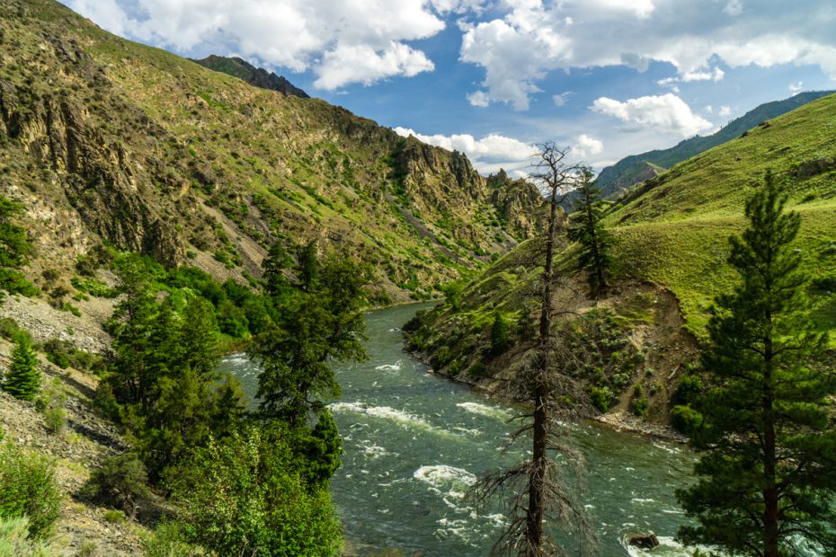
- 63 miles of the Green River (including Labyrinth Canyon) in Utah (Emery County Public Land Management Act)
- 110 miles in the Wood-Pawcatuck watershed in Rhode Island and Connecticut
- 52.8 miles of the Nashua River and tributaries in New Hampshire and Massachusetts
- 77.2 miles of river in southern California (California Desert Protection Act)
View map in full browser window
Wild and Scenic Designations
In 1968, facing public pressure to protect rivers from the rapidly-increasing threat of urban pollution and dam building, Congress passed the Wild and Scenic Rivers Act (WSRA). The Act declares that:
“…certain selected rivers of the Nation which, with their immediate environments, possess outstandingly remarkable scenic, recreational, geologic, fish and wildlife, historic cultural, or other similar values, shall be preserved in free-flowing condition, and that they and their immediate environments shall be protected for the benefit and enjoyment of present and future generations…”
Wild and Scenic Rivers are given one of three designations: “Wild,” “Scenic,” or “Recreational.” To quickly paraphrase the official definitions, wild sections are free of dams, relatively undeveloped on the banks, and accessible (for the most part) only by trail. Scenic river sections are also free of dams and relatively undeveloped, but may be closer to a road. Recreational river sections are easily accessible, might have dams or diversions that were placed before the river was designated, and may travel through developed areas. Each of these designations comes with corresponding protections that aim to maintain the existing state of the river.
Rivers can be designated Wild and Scenic through a process initiated by states, but typically, they are designated by Congressional order. When Congress designates a river, they specify the section and the federal agency that will be responsible for managing it. They may or may not define the designation — that can be left up to the agency.
Prior to the Dingell Act, the Wild and Scenic River System protected 12,754 miles along 209 rivers.
The NPS regrettably don’t include the legend on the map itself, so here it is:
- Tan – Wild & Scenic Rivers managed by non-NPS agencies.
- Blue – designated national wild and scenic rivers where NPS has a role.
- Orange – Congressionally authorized wild and scenic study rivers where NPS has a role.
- Green – rivers in national park units with enabling legislation provisions similar to those on national wild and scenic rivers.
Protections
The protections that the Act provides are somewhat vague and can be legally challenging. The goal of the Act is to force the federal government to manage designated rivers in such a way that their current state — and their “outstanding values” — can be preserved. The specific protections are listed below, but the Act is very careful not to override existing state level rights and management, and so the legal particulars are often situational.
- Grants a federal water right to available water in the stream (i.e. junior to any water rights existing prior to the river’s designation). This water is to be used to achieve the act’s purposes — maintaining the river’s wild and scenic characteristics through guarantee of in-stream flow.
- Prohibits federal support for or involvement in any water- or energy-related project on or affecting any river that is designated as part of the Wild and Scenic river system.
- Prohibits FERC (Federal Energy Regulatory Commission) licensing of any project that would affect a river in the system. This de facto prohibits dam construction on Wild and Scenic Rivers even if the federal government is not involved in the proposal.
Wild and Scenic Rivers are managed by different federal agencies. When a river is designated, the managing agency is required to create a management plan the goal of which is to preserve the qualities that led to the river’s designation. Exactly what that entails for a given river depends on why the river was designated and which designation it was given. The WSRA explicitly tasks managing agencies with interfacing with state governments, private landholders, and other stakeholders to ensure that the rivers’ qualities are maintained and it gives special mention to water quality, timber harvesting, and road construction.

How Do Rivers Become “Wild and Scenic?”
Congress can designate rivers to be studied for possible inclusion as Wild and Scenic, and there’s a national inventory of rivers that potentially qualify for Wild and Scenic status, but the reality is that the majority of designations happen as a result of grassroots community efforts. Congressional staff aren’t sitting around reviewing the National Hydrography Dataset and deciding what rivers should be designated — and unfortunately most of them probably aren’t going on wilderness float trips down those rivers — so it comes down to community action and initiative to get rivers to the table for designation.
There are a number of non-profits campaigning for growing the National Wild and Scenic River System and community input is important for getting rivers into consideration. Check out American Rivers’ “5000 Miles of Wild” campaign for more info.
Other Resources
- National River Inventory (NRI) map — the NRI is an inventory of US rivers that have been identified as potentially having “outstandingly remarkable” values and thus warrant inclusion in the Wild and Scenic River System.
- National Wild and Scenic River System website
- The Wild & Scenic River Study Process
- Impacts of Wild and Scenic River Designation, a Utah State University study